The evidence which gave rise to the theory of continental drift, more accurately known as plate tectonics includes :
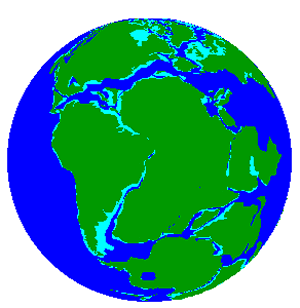
The coasts of the continents surrounding the Atlantic ocean could fit together like a jigsaw puzzle, as shown on the right, and appear to have originated from one huge land mass. The most logical explanation was that the continents themselves were once parts of a much larger "super-continent" which was named Pangaea.
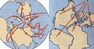
For the glaciers to have been present with the continents in their current positions, much of the world should have been under ice. But this wasn't the case.
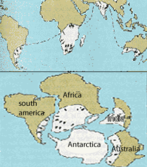
Living animals in widely separated lands are similar. For example India and Madagascar have similar mammals, which are quite different from those in Africa, even though it is now near to Madagascar.
Fossil plants in India, South Africa, Australia, Antarctica and South America are similar to each other. This flora is quite different from plants found in other parts of the world at the same time.
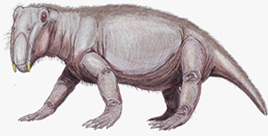
The same applies to fossil animals. An example is the discovery of fossils of the aquatic reptile Lystrosaurus, shown on the right, from rocks of the same age from locations in South America, Africa, and Antarctica.
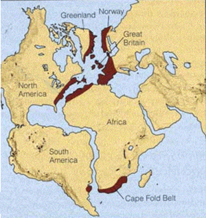
There are numerous geological similarities between South America and Western Africa . For example, mountain ranges on both continents match up, as shown on the right, as do coal fields in North America and Europe
When liquid magma cools and becomes solid rock, some of the minerals in the rock preserve a record of the direction and strength of the magnetic field at that time. This "recording" is called paleomagnetism. Lava is regularly pouring from the mid-oceanic ridges as the oceanic floor moves away from the ridge similar to a conveyer belt system. As the lava cools it acts something like a magnetic recording of magnetic reversals. Since the age of the reversals is known, the speed of plate movement can be precisely calculated through time.
If we look at the magnetic properties of present day rocks, as shown on the left of the image on the right, we can see that there is no correlation to the direction of the pole. However if we change the continents as they were during Pangaea and date the rocks we find that they align to a common pole.
Paleomagnetism tells us how far from the poles rocks were when they formed, by looking at the angle of their magnetic field. The story told by different continents is contradictory, and can only be explained if we assume the continents have moved over time.
1) How did fossils provide evidence for continental drift?
2) Explain the term paleomagnetism. How is paleomagnetism used to support the theory of continental drift.?
3) Is any one piece of evidence overwhelming support for continental drift?
4) What is the geological evidence for continental drift?
5) What are glacial till deposits? How are they used to support continental drift?