Geology on Mars
Part 2
This unit of work was adapted from https://solarsystem.nasa.gov/docs/Geologic_Landforms_Mars.pdf 7/01/2016 3.23 pm
The same four geological processes that are shaping Earth have int he past shaped and are still shaping the surface of Mars. These four processes are volcanism, gradation, impact cratering and tectonism. Mars is home to some of the largest volcanoes in the solar system and scientists believe that they are dormant as opposed to extinct.
Gradation is a collection of processes, such as weathering, that work to break down or loosen rock and displace the material from one location to another. The relocation of material can be through, water, wind or gravity as happens in landslides. Large valleys, similar to those created by water here on Earth and dried river beds are evidence that liquid water once flowed on the surface of Mars. Surface temperatures below freezing and low atmospheric pressure means that water is no longer involved in gradation on the surface of Mars.
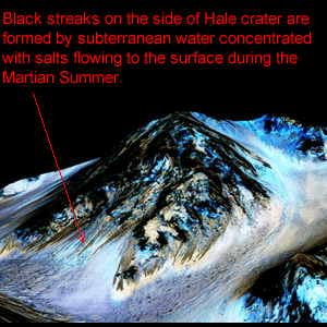
There is evidence that a great deal of water once existed on the surface of Mars, the question remains, where did it go? Some of the water most likely escaped into space while there is evidence to suggest that water probably seeped into the ground and remains frozen there as ice. In September 2015 NASA released, images of dark streaks on the side of Hale crater, known as recurring surface lineae, thought to be formed by salty water escaping from beneath the surface as it melts during the Martian summer. The fact that this water is salty accounts for the observation that the water is a liquid at such low temperatures, much like adding salt to icy roads to lower its melting point. Ice water is also present in the polar caps which shrink during summer and grow during winter.
When looking at the surface of a planet such as Mars we can tell a great deal about its past by analysing the surface features, such as the craters, valleys and the degree to which these features have degraded. For example, older Martian surfaces have more craters which a larger and generally more degraded when compared to those found on younger surfaces. Young crates have upraised rims with steep sides while older craters have partial rims which are less steep.
Lets look at some examples of how geologists use satellite photographs to determine the age and sequence of events that occurred on the Martian planet.
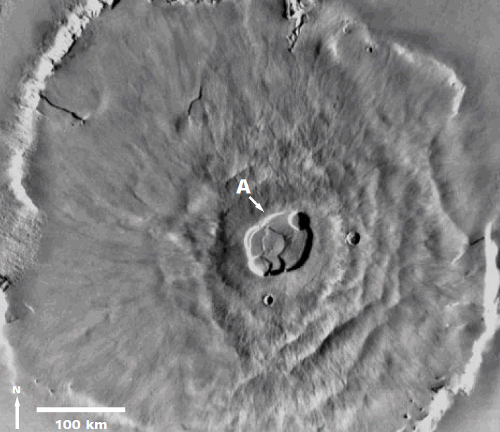
1) Olympus Mons is a shield volcano 600 km in diameter, rising 25 km above the surrounding plain, shown on the left. Around its base is a steep cliff as high as 6 km.
a) Examine the caldera (labeled A) and estimate its diameter.
b) Do you think the surface of Olympus Mons is geologically old or young, when compared to the surface of the
Moon? Explain your answer.
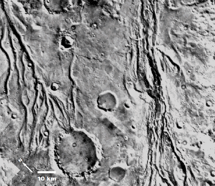
2) Valleys west of Chryse Planitia. Similar to some river systems on Earth, these martian channels have a branching pattern.
a) In what direction did the water flow?
b. Is this a relatively old or young region of Mars? Explain
c. Are the craters you observe older or younger than the valleys? Justify your answer.
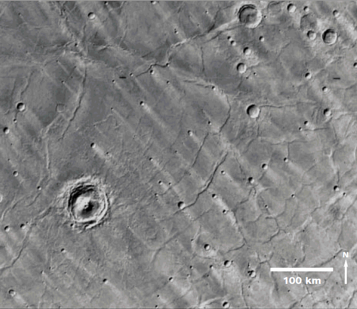
3) The Hesperia region in the southern hemisphere consists of cratered plains which have been modified by wind. Wind-produced features, called bright wind streaks, are associated with many craters.
a) Describe the appearance and orientation of the wind streaks
b) If wind streaks are dust deposits formed downwind from the craters, what was the direction of the wind that formed these streaks? (Wind direction refers to the direction from which the wind is coming from.)
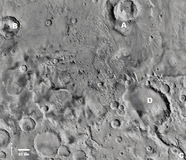
4) Apollinaris Patera (A) and surrounding region.
a) Based on your observations, what is the probable order of occurrence of A, B, C, and D. (i.e., which came first, second, third, last)? Give evidence for your answer.
b) The region around Gusev crater (D) slopes North. What type of material or rock comprises the floor of Gusev? Explain